
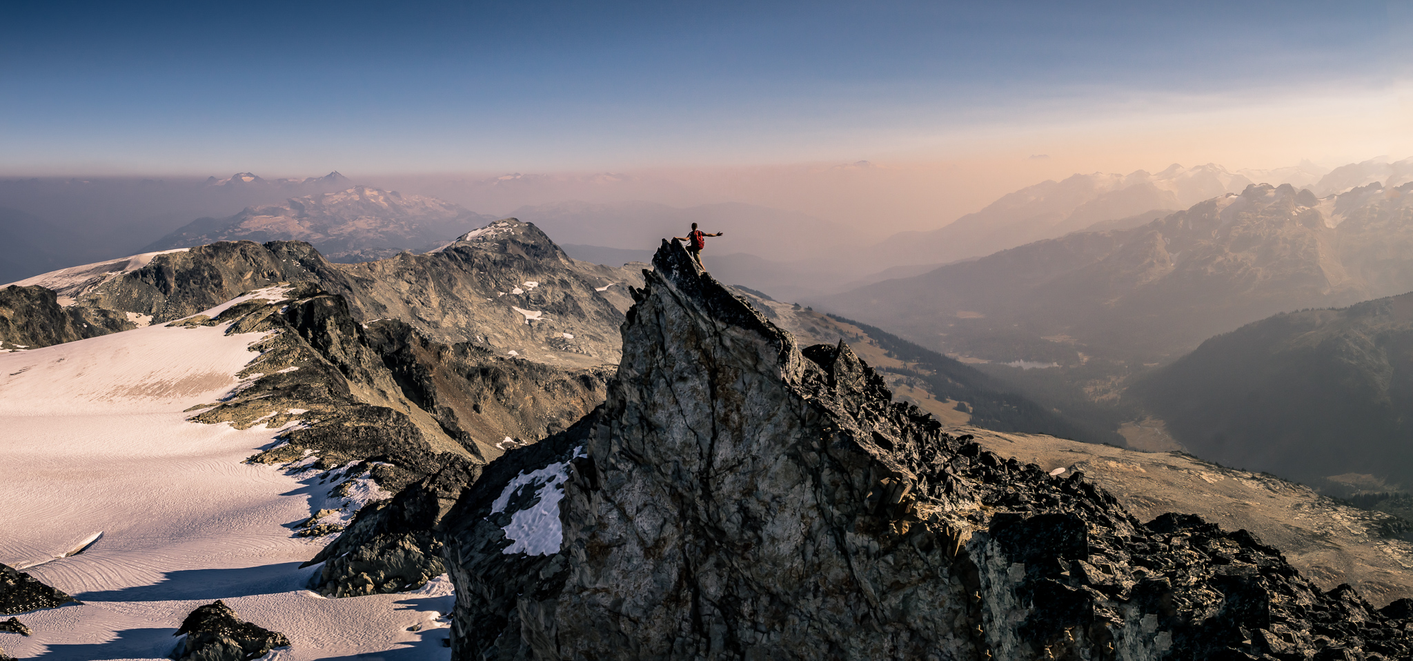
Peakbagging in Vancouver: 101 Peaks to Bag in and around SWBC

Whether it’s Scrambles in SWBC or 105 Hikes in and Around SWBC, hikers (and especially peakbaggers) seem to enjoy completing lists. People find satisfaction and motivation in objective based hiking & scrambling, so I wanted to throw my hat in the ring and create a list that may offer something to any aspiring completionists in SWBC.
While Scrambles in SWBC is a fantastic book, since the book was written back in 2005 there are only a handful of people (if that) that have actually completed the list. This is because of a few reasons, with the main issues being changes in accessibility making some peaks almost impossible to reach, and the fact that some of the peaks on the list are simply way beyond the risk tolerance of some people. To complete the list now would take a monumental amount of effort that most people aren’t dedicated enough to even bother trying.
On the other end of the spectrum, 105 Hikes in and Around SWBC is another great local hiking book filled with hikes for all abilities, however it’s more tailored to hiking rather than peakbagging, with the majority of the book a fairly simple trail rather than a peak, and peakbaggers are primarily the ones that like to complete lists. There aren’t many people that aspire to complete all of these hikes.
What's Different About This List?
This list is essentially the list of my favourite peaks over several years of bagging more than 200 peaks, and one that I think should be attainable to most people that are willing and able to put in the time. I didn’t want to create a list that only the elite handful can ever finish, nor did I want a list that is too easy to complete. Hopefully I’ve found a good balance of challenge and accessibility for most outdoor enthusiasts to be able to finish.


Some facts about this list before you dive into it:
- Every peak should be attainable for most technical abilities, and the majority of peaks are just hiking or simple scrambling. None of the scrambling should ever be above Class 3, and most will be below that.
- Every peak should be attainable as a day trip from the Lower Mainland. The longest drive should be no more than 3.5 hours (one-way) from Vancouver, with the majority well under that. Of course, you will need to be willing to wake up early and finish late to complete some of these in a day (including driving), so some people may prefer to overnight some of them.
- Every peak will offer worthwhile views relative to effort, assuming you climb it in favorable weather. None of the peaks on this list will end up on a forested summit with nothing to see, which I know some peakbaggers are quite accustomed to.
- Most of the peaks are physically demanding hikes. While there are a few easy hikes, the majority (~80%) would be considered difficult or very difficult by the average hiker. This is simply because the most rewarding peaks are typically the most demanding. Peakbaggers are generally very fit individuals, so physical difficulty usually isn’t much of a deterrent anyway. As such, physical difficulty has had little impact as to whether a peak is considered Beginner, Intermediate or Advanced (see below).
- The list includes winter objectives, some of which more or less require snow travel. Of course, avalanche knowledge, gear, training and favorable conditions are all a necessity for some of the winter objectives on this list. Most routes that require snow travel have been considered Advanced routes due to the increased risk and skill level required.
- At the time of writing, all of the peaks are accessible, though many will require a high clearance vehicle, preferably a 4×4 with A/T tires. Note: FSR conditions can change at a moment’s notice, so as the years pass access may unfortunately change. Since these lists are made to be completed as is, I will not be changing the peaks on the list, even if the FSR to reach it becomes impassable. If that’s the case, what may have been a day hike previously could turn into an overnight hike, or just a much more difficult day hike.
- There is a broad array of peaks from all of the typical hiking spots around SWBC and northern Washington included in the list. One of the great things about peakbagging is that it forces you into exploring regions you may never have thought of exploring before, and hopefully this list encourages you into doing so.


I’ve tried to maintain a fairly equal balance of Beginner, Intermediate and Advanced peaks so as to allow steady progression through the list. In terms of Difficulty ratings:
- Beginner – Mostly just hiking, perhaps with a very simple scramble. There should be little to no exposure, and little in the way of route finding, as most of the hike follows an established trail
- Intermediate – Potentially some easy to moderate scrambling with mild exposure. Typically more involved route finding with off trail hiking a necessity in parts. Snow travel may be required or optional.
- Advanced – The hike will usually involve either scrambling (possibly exposed), significant off-trail route finding and/or snow travel.
In terms of the Snow Travel column:
- No – The peak does not benefit from snow coverage and it is generally not advised to attempt it in snow.
- Optional – People summit this peak both with and without snow at their discretion.
- Yes – The peak benefits from snow coverage and it is generally advised to summit in snow.
Snow doesn’t necessarily mean “winter”. Often a peak is easiest to summit in spring, when access is feasible but snow coverage is still around at higher elevations. Mount Ronayne is a good example of this. If in doubt, read the detailed description for the peak in question for seasonality.
- In terms of the Route Finding column, while I strongly advise everyone to be taking an offline map (and backup map) for navigation no matter what hike you are going on, below are some general comments:
- Minimal – You are either following a trail or an obvious route the whole way to the summit.
- Moderate – You may be following an obvious trail/route for some of the hike, with a portion of the hike requiring self-navigation. Navigation is generally straightforward.
- Significant – A large amount of the hike requires self-navigation, with little or no trail/markers to follow. You are entirely self-reliant on finding your own way to the summit.
- Not every peak on this list is an “official” peak, for example Seagram Peak and Blanca Peak are unofficial peaks, however I have included them in the list as they are worthwhile hikes to very scenic spots that I think people should visit.
- There are more than 101 peaks on this list, as some hikes (e.g. Train Glacier Traverse) include multiple peaks.


Stay Safe Out There
Many of the hikes on this list are above and beyond simple front country trails, requiring significant self-reliance in the backcountry. I’ve written a post about hiking safely in British Columbia, as well as how to prepare for a hike in all seasons (including winter). Unfortunately every year SAR receives hundreds of calls from people going on hikes, many of which are the result of poor planning and preparation. I strongly encourage you to read both of the articles above, especially if you are planning on attempting the winter objectives on this list. I won’t go into great detail again here, but the key takeaways are:
- Leave a trip plan
- Take the 10 Essentials (I strongly advise to go beyond the 10 Essentials – these are the minimum)
- Hike in a group and stick together
- Prepare for animal encounters, especially bears
- Begin your hike early, the earlier the better, especially in winter
- Research your hike in advance:
- Understand the route/terrain – Is it on trail or off trail? Is there any scrambling involved? What is the avalanche risk? Is there a glacier? How long do you expect to take?
- Understand the conditions – Will there be snow? Where is the snowline approximately? Will the snow be deep powder or consolidated? What will the weather be like? What time is sunrise/sunset? Is there any shade? Is there anywhere to fill up water?
- Pack appropriately – Do you need a helmet? Do you need snowshoes/crampons/microspikes/ice axe/ avalanche gear? How much water/food do you need?
- Understand the access – Can you reach the trailhead in your vehicle? Is the road free of snow?
In particular, for any of the snow based summits, I strongly urge you to take your AST-1 course as a minimum. Winter travel should not be taken lightly.
With all that said & without further ado, please find the list below. You can click any of the links to find detailed information about each hike, as well as filter the table based on what you’re looking for. You can also export the table to track your completion status. Last but not least, I hope you have as much fun completing this list as I did.
Disclaimer: Many of the hikes on this list involve a number of risks, including but not limited to: exposed scrambling, self-navigated backcountry travel, rockfall, avalanches, glacier travel and animal encounters. Hikers should be prepared with appropriate education, training and equipment for all possibilities. You are responsible for your own safety and I take no responsibility should you decide to pursue any of the hikes on this website.
The below table works best on a desktop.
| # | HIKE NAME | RANKING | DIFFICULTY | SCRAMBLING | EXPOSURE | ROUTE FINDING | SNOW TRAVEL | REGION |
|---|---|---|---|---|---|---|---|---|
| 1 | Dog Mountain | ☆☆☆☆ | Beginner | None | None | Minimal | Optional | North Shore & Lions Bay |
| 2 | Hollyburn Peak | ☆☆☆ | Beginner | None | None | Minimal | Optional | North Shore & Lions Bay |
| 3 | Pump Peak | ☆☆☆☆ | Beginner | None | None | Minimal | Optional | North Shore & Lions Bay |
| 4 | Mount Seymour | ☆☆☆☆ | Beginner | None | None | Minimal | No | North Shore & Lions Bay |
| 5 | Mount Strachan | ☆☆☆ | Beginner | None | None | Minimal | Optional | North Shore & Lions Bay |
| 6 | Unnecessary Mountain | ☆☆☆☆ | Beginner | None | None | Minimal | No | North Shore & Lions Bay |
| 7 | Hat Mountain | ☆☆☆☆ | Beginner | Easy | None | Minimal | No | North Shore & Lions Bay |
| 8 | Mount Burwell | ☆☆☆☆ | Beginner | None | None | Minimal | No | North Shore & Lions Bay |
| 9 | Brunswick Mountain | ☆☆☆☆☆ | Intermediate | Moderate | Moderate | Minimal | No | North Shore & Lions Bay |
| 10 | Crown Mountain | ☆☆☆☆ | Intermediate | Easy | Moderate | Minimal | No | North Shore & Lions Bay |
| 11 | Mount Harvey | ☆☆☆☆☆ | Intermediate | Easy | Mild | Minimal | Optional | North Shore & Lions Bay |
| 12 | Stawamus Chief | ☆☆☆☆ | Beginner | None | None | Minimal | No | Squamish Area |
| 13 | Slhanay Peak | ☆☆☆☆ | Beginner | None | None | Minimal | No | Squamish Area |
| 14 | Seed Peak | ☆☆☆☆☆ | Beginner | None | None | Moderate | No | Squamish Area |
| 15 | Alpen Mountain | ☆☆☆☆ | Intermediate | Moderate | Mild | Moderate | Yes | Squamish Area |
| 16 | Anif Peak | ☆☆☆☆ | Intermediate | Easy | None | Moderate | Yes | Squamish Area |
| 17 | Tricouni Peak | ☆☆☆☆☆ | Intermediate | Moderate | Mild | Moderate | No | Squamish Area |
| 18 | Seagram Peak | ☆☆☆☆☆ | Intermediate | None | None | Moderate | No | Squamish Area |
| 19 | Cloudburst Mountain | ☆☆☆☆ | Advanced | Easy | None | Significant | Optional | Squamish Area |
| 20 | Mount Brew / Keg Peak | ☆☆☆ | Beginner | None | None | Minimal | No | Whistler Area |
| 21 | Metal Dome | ☆☆☆☆ | Intermediate | None | None | Moderate | Optional | Whistler Area |
| 22 | Brandywine Mountain | ☆☆☆☆☆ | Intermediate | Easy | None | Minimal | No | Whistler Area |
| 23 | Gin Peak | ☆☆☆☆☆ | Intermediate | None | None | Moderate | Yes | Whistler Area |
| 24 | Mount Sproatt | ☆☆☆☆ | Intermediate | None | None | Minimal | Optional | Whistler Area |
| 25 | Blanca Peak | ☆☆☆☆ | Intermediate | Easy | None | Moderate | No | Whistler Area |
| 26 | Sootip Peak | ☆☆☆☆ | Intermediate | None | None | Moderate | No | Whistler Area |
| 27 | Blackcomb Peak & The Spearhead | ☆☆☆☆☆ | Advanced | Easy | None | Significant | No | Whistler Area |
| 28 | Cypress Peak | ☆☆☆☆ | Advanced | Moderate | Moderate | Significant | No | Whistler Area |
| 29 | Spectrum Peak | ☆☆☆☆☆ | Advanced | Moderate | Mild | Significant | Yes | Whistler Area |
| 30 | Mount Callaghan | ☆☆☆☆☆ | Advanced | Moderate | Mild | Moderate | No | Whistler Area |
| 31 | Mount Rohr | ☆☆☆☆☆ | Beginner | None | None | Moderate | No | Pemberton / Duffey Lake |
| 32 | Sugarloaf Mountain | ☆☆☆☆☆ | Intermediate | Moderate | None | Moderate | Optional | Pemberton / Duffey Lake |
| 33 | Mount Barbour | ☆☆☆☆☆ | Intermediate | Easy | None | Moderate | No | Pemberton / Duffey Lake |
| 34 | Mount Taylor | ☆☆☆☆☆ | Intermediate | None | None | Moderate | Optional | Pemberton / Duffey Lake |
| 35 | Tenquille Mountain | ☆☆☆☆☆ | Intermediate | Easy | Mild | Significant | No | Pemberton / Duffey Lake |
| 36 | Sun God & Seven O’ Clock Mountain | ☆☆☆☆☆ | Advanced | Easy | Mild | Significant | No | Pemberton / Duffey Lake |
| 37 | Cayoosh Mountain | ☆☆☆☆☆ | Advanced | Moderate | Moderate | Significant | Yes | Pemberton / Duffey Lake |
| 38 | Mount Ronayne | ☆☆☆☆☆ | Advanced | None | None | Significant | Yes | Pemberton / Duffey Lake |
| 39 | Mount Caspar | ☆☆☆☆☆ | Advanced | None | None | Significant | Yes | Pemberton / Duffey Lake |
| 40 | Vantage Peak | ☆☆☆☆☆ | Advanced | Moderate | Moderate | Moderate | Optional | Pemberton / Duffey Lake |
| 41 | Mount Marriott | ☆☆☆☆☆ | Advanced | Moderate | Moderate | Significant | Optional | Pemberton / Duffey Lake |
| 42 | Train Glacier Traverse | ☆☆☆☆☆ | Advanced | Moderate | Mild | Significant | No | Pemberton / Duffey Lake |
| 43 | Mount Gandalf & Aragorn | ☆☆☆☆☆ | Advanced | Easy | Mild | Significant | No | Pemberton / Duffey Lake |
| 44 | Saxifrage Peak | ☆☆☆☆☆ | Advanced | None | None | Significant | Optional | Pemberton / Duffey Lake |
| 45 | Cottonwood Peak | ☆☆☆☆☆ | Advanced | Easy | None | Significant | Optional | Pemberton / Duffey Lake |
| 46 | Mount Chief Pascall | ☆☆☆☆☆ | Advanced | Moderate | Mild | Significant | Yes | Pemberton / Duffey Lake |
| 47 | Panorama Ridge | ☆☆☆☆☆ | Beginner | None | None | Minimal | No | Garibaldi Provincial Park |
| 48 | Diamond Head | ☆☆☆☆ | Intermediate | None | None | Moderate | Optional | Garibaldi Provincial Park |
| 49 | Manic Peak | ☆☆☆☆ | Intermediate | Easy | None | Moderate | No | Garibaldi Provincial Park |
| 50 | Mount Price | ☆☆☆☆☆ | Intermediate | None | None | Significant | Optional | Garibaldi Provincial Park |
| 51 | Mount Cook | ☆☆☆☆ | Intermediate | Easy | None | Moderate | No | Garibaldi Provincial Park |
| 52 | The Black Tusk | ☆☆☆☆☆ | Advanced | Moderate | Severe | Moderate | No | Garibaldi Provincial Park |
| 53 | Mount Weart | ☆☆☆☆☆ | Advanced | Moderate | Mild | Moderate | No | Garibaldi Provincial Park |
| 54 | Overlord Mountain | ☆☆☆☆☆ | Advanced | Moderate | Moderate | Moderate | No | Garibaldi Provincial Park |
| 55 | Evans Peak | ☆☆☆ | Beginner | None | None | Minimal | Optional | Golden Ears / Mission / Harrison |
| 56 | Alouette Mountain | ☆☆☆☆ | Beginner | None | None | Minimal | Optional | Golden Ears / Mission / Harrison |
| 57 | Slollicum Peak | ☆☆☆☆ | Beginner | None | None | Minimal | Optional | Golden Ears / Mission / Harrison |
| 58 | Mount Crickmer | ☆☆☆☆ | Intermediate | None | None | Minimal | Optional | Golden Ears / Mission / Harrison |
| 59 | Golden Ears Peak | ☆☆☆☆☆ | Advanced | Moderate | Moderate | Moderate | No | Golden Ears / Mission / Harrison |
| 60 | Elk Mountain | ☆☆☆☆ | Beginner | None | None | Minimal | Optional | Chilliwack / Abbotsford Area |
| 61 | Sumas Mountain | ☆☆☆ | Beginner | None | None | Minimal | Optional | Chilliwack / Abbotsford Area |
| 62 | Mount Mercer | ☆☆☆☆ | Beginner | None | None | Minimal | Optional | Chilliwack / Abbotsford Area |
| 63 | Flora Peak | ☆☆☆☆☆ | Beginner | None | None | Minimal | No | Chilliwack / Abbotsford Area |
| 64 | Mount Cheam | ☆☆☆☆☆ | Beginner | None | None | Minimal | No | Chilliwack / Abbotsford Area |
| 65 | Mount Laughington | ☆☆☆☆ | Intermediate | None | None | Minimal | Optional | Chilliwack / Abbotsford Area |
| 66 | Mount MacFarlane | ☆☆☆☆☆ | Intermediate | Easy | Mild | Minimal | No | Chilliwack / Abbotsford Area |
| 67 | Conway Peak | ☆☆☆☆☆ | Intermediate | None | None | Moderate | Optional | Chilliwack / Abbotsford Area |
| 68 | Mount Lindeman | ☆☆☆☆☆ | Advanced | Easy | Mild | Significant | No | Chilliwack / Abbotsford Area |
| 69 | Mount McGuire | ☆☆☆☆☆ | Advanced | Moderate | Moderate | Moderate | No | Chilliwack / Abbotsford Area |
| 70 | Thompson Peak | ☆☆☆☆☆ | Advanced | None | None | Significant | Yes | Chilliwack / Abbotsford Area |
| 71 | MacDonald Peak | ☆☆☆☆☆ | Advanced | Moderate | Mild | Moderate | No | Chilliwack / Abbotsford Area |
| 72 | Williams Peak | ☆☆☆☆☆ | Advanced | Easy | Mild | Moderate | No | Chilliwack / Abbotsford Area |
| 73 | Hope Mountain | ☆☆☆☆ | Beginner | None | Mild | Minimal | No | Hope & Coquihalla |
| 74 | Wells Peak | ☆☆☆☆ | Beginner | Easy | Mild | Moderate | No | Hope & Coquihalla |
| 75 | The Flatiron | ☆☆☆☆☆ | Beginner | None | None | Minimal | Optional | Hope & Coquihalla |
| 76 | Zoa Peak | ☆☆☆☆ | Beginner | None | None | Minimal | Optional | Hope & Coquihalla |
| 77 | Jim Kelly Peak & Illal Mountain | ☆☆☆☆ | Intermediate | Easy | Mild | Minimal | No | Hope & Coquihalla |
| 78 | Needle Peak | ☆☆☆☆☆ | Intermediate | Moderate | Mild | Moderate | No | Hope & Coquihalla |
| 79 | Yak Peak | ☆☆☆☆ | Intermediate | Easy | Mild | Minimal | No | Hope & Coquihalla |
| 80 | Zupjok, Llama & Alpaca Peak | ☆☆☆☆ | Intermediate | Easy | None | Minimal | No | Hope & Coquihalla |
| 81 | Iago Peak | ☆☆☆☆ | Intermediate | None | None | Significant | Yes | Hope & Coquihalla |
| 82 | Coquihalla Mountain | ☆☆☆☆☆ | Advanced | Moderate | Mild | Moderate | No | Hope & Coquihalla |
| 83 | Guanaco Peak | ☆☆☆☆ | Advanced | Easy | None | Significant | No | Hope & Coquihalla |
| 84 | Frosty Mountain (False Summit) | ☆☆☆☆ | Beginner | Easy | None | Minimal | No | Manning Park |
| 85 | Lone Goat & Snow Camp Mountain | ☆☆☆☆ | Beginner | None | None | Minimal | No | Manning Park |
| 86 | Three Brothers Mountain | ☆☆☆☆ | Beginner | None | None | Minimal | No | Manning Park |
| 87 | Mount Outram | ☆☆☆☆☆ | Intermediate | Moderate | Moderate | Minimal | No | Manning Park |
| 88 | Frosty Mountain (True Summit) | ☆☆☆☆☆ | Advanced | None | Mild | Significant | Yes | Manning Park |
| 89 | Excelsior Peak | ☆☆☆☆ | Beginner | None | None | Minimal | Optional | Washington |
| 90 | Hannegan Peak | ☆☆☆☆ | Beginner | None | None | Minimal | No | Washington |
| 91 | Yellow Aster Butte | ☆☆☆☆☆ | Beginner | None | None | Minimal | No | Washington |
| 92 | Trappers Peak | ☆☆☆☆ | Intermediate | Easy | Mild | Minimal | No | Washington |
| 93 | Goat Mountain West | ☆☆☆☆☆ | Intermediate | Easy | None | Minimal | No | Washington |
| 94 | Hidden Lake Peak | ☆☆☆☆☆ | Intermediate | Moderate | Mild | Moderate | No | Washington |
| 95 | Vesper Peak | ☆☆☆☆ | Intermediate | Easy | None | Minimal | No | Washington |
| 96 | Mazama Dome | ☆☆☆☆☆ | Intermediate | Easy | Mild | Moderate | Optional | Washington |
| 97 | Gunn Peak | ☆☆☆☆☆ | Advanced | Moderate | Moderate | Moderate | No | Washington |
| 98 | Gothic Peak | ☆☆☆☆ | Advanced | Moderate | Moderate | Moderate | No | Washington |
| 99 | Hadley Peak | ☆☆☆☆☆ | Advanced | Easy | Mild | Moderate | No | Washington |
| 100 | Mount Ann | ☆☆☆☆☆ | Advanced | None | None | Significant | Yes | Washington |
| 101 | Ruth Mountain | ☆☆☆☆☆ | Advanced | None | None | Significant | Yes | Washington |